 BGS Data Catalogue
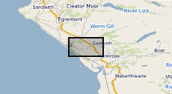
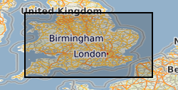
Gravity surveys
Type of resources
Topics
Keywords
Contact for the resource
Provided by
Years
Formats
Representation types
Update frequencies
Scale
-

Field notebooks,maps, field sheets etc for Regional gravity observations on the UK mainland, Northern Ireland, offshore islands, tidal estuaries and seabed. Most of the surveys were carried out by the BGS but the database includes data originally acquired by other organisations and subsequently given to the BGS to be managed as part of the national archive. Complete coverage of the UK mainland with a station density of 1-2 stations per square kilometre.
-
A significant part of this data collection is geophysical survey data in digital form being derived data created during the subsequent processing and interpretation of the field data described in 'Nirex Magnetic Tape Archives - Raw Data'. These data were originally stored on a variety of media. With the overall aim of delivering an efficient and effective archive service, the data have been consolidated onto DLT cartridges. Some related data, which were either analogue, on obscure media or in unknown formats have been retained in their original form. British Geological Survey maintains a full catalogue of the data, as an Access database. The data sets that comprise the magnetic archive are the following: Seismic surveys: demultiplexed and processed data; Geophysical wireline logging of boreholes: wireline derived data including synthetic seismograms; cross-hole tomography. The ownership of NIREX (Nuclear Industry Radioactive Waste Executive) was transferred from the nuclear industry to the UK Government departments DEFRA and DTI in April 2005, and then to the UK's Nuclear Decommissioning Authority (NDA) in November 2006.
-
Indexes and data records for Regional gravity observations on the UK mainland, Northern Ireland, offshore islands, tidal estuaries and seabed. Records include station identities, position, gravity reading and reduced gravity values. Most of the surveys were carried out by the BGS but the database includes data originally acquired by other organisations and subsequently given to the BGS to be managed as part of the national archive. Complete coverage of the UK mainland with a station density of 1-2 stations per square kilometre.
-
Corrected and smoothed and network adjusted ship gravity, magnetics and bathymetry data acquired by BGS as part of its Offshore Reconnaissance Mapping Programme. This programme was commenced in 1967, funded mainly by the Department of Energy.
-

A significant part of this data collection is geophysical survey data in digital form, being mainly instrumental recordings made during fieldwork. Derived data created during the subsequent processing and interpretation of the field data is described in 'Nirex Magnetic Tape Archives - Processed Data'. These data were originally stored on a variety of media. With the overall aim of delivering an efficient and effective archive service, the data have been consolidated onto DLT cartridges. Some related data, which were either analogue, on obscure media or in unknown formats have been retained in their original form. British Geological Survey maintains a full catalogue of the data, as an Access database.The data sets that comprise the magnetic archive are the following: Seismic surveys: marine, land and transition zone; field, navigation, statiatcs; Geophysical wireline logging of boreholes: routine wireline logging of investigation boreholes (gamma-ray, sonic, porosity, etc.); velocity surveys; dipmeter surveys;vertical seismic profiling; borehole televiewer (BHTV) surveys; formation microscanner (FMS) surveys; Ground surveys: magnetic; gravity; radiometric; thermal imaging; photographic imaging; in-flight videos. The ownership of NIREX (Nuclear Industry Radioactive Waste Executive) was transferred from the nuclear industry to the UK Government departments DEFRA and DTI in April 2005, and then to the UK's Nuclear Decommissioning Authority (NDA) in November 2006.
-
This dataset is the complete collection of the British Geological Survey (BGS) held Marine Survey data. The data held includes digital data and analogue records, plus associated physical sample material. Data are stored within the National Geosciences Data Centre (NGDC) and the Marine Environmental Data and Information Network (MEDIN) Data Archive Centre (DAC) for Geology and Geophysics. BGS have collected Marine Survey data since 1966 and have also been provided with a range of third-party data. The data includes geophysical data (seismic reflection, side-scan sonar, multibeam echosounder bathymetry and backscatter, gravity and magnetics) and sample data from boreholes, cores and seabed grabs (logs, geological descriptions, geochemical, particle size analysis and geotechnical data). The majority of surveys are within the United Kingdom Continental Shelf (UKCS) area. Individual survey data coverage varies, depending on survey type (sampling, geophysics, multibeam or multi-disciplinary) and objectives (regional or local, shallow or deep). These data are applicable to a wide range of uses including environmental, geotechnical, geophysical and geological studies. Data are delivered via the BGS Offshore GeoIndex www.bgs.ac.uk/GeoIndex/offshore.htm. Additional data are available on request enquiries@bgs.ac.uk.
-
The Marine Aggregate Levy Sustainability Fund (MALSF) commissioned a series of Regional Environmental Characterisation (REC) surveys via the Marine Environment Protection Fund (MEPF) to develop understanding of submerged habitats and heritage in Britain. The aim was to acquire high quality data to enable broad scale characterisation of the seabed habitats, their biological communities and potential historic environment assets. The surveys were conducted in the following areas - Outer Bristol Chanel (2003 – 2005), Eastern English Channel (2005 – 2006), South Coast (2007 - 2010), Outer Thames (2007), East Coast (2008 - 2009), Humber (2008 - 2009). The Geology and Geophysics component of the data are archived by British Geological Survey (BGS) in the Marine Environmental data and Information Network (MEDIN) Data Archive Centre (DAC) for Geology and Geophysics. The data includes bathymetry, sidescan sonar, sub-bottom profiler, magnetometer, seabed video and photographs, Particle Size Analysis (PSA) data, vibrocore (logs and images). Data are delivered via the BGS Offshore GeoIndex www.bgs.ac.uk/GeoIndex/offshore.htm. Additional data are available on request enquiries@bgs.ac.uk. Other data types have been archived with the other MEDIN DACs as appropriate (UKHO DAC for bathymetry data and DASSH DAC for biological data). The MALSF ceased operation at the end of March 2011 (http://www.marinealsf.org.uk/).